Caption
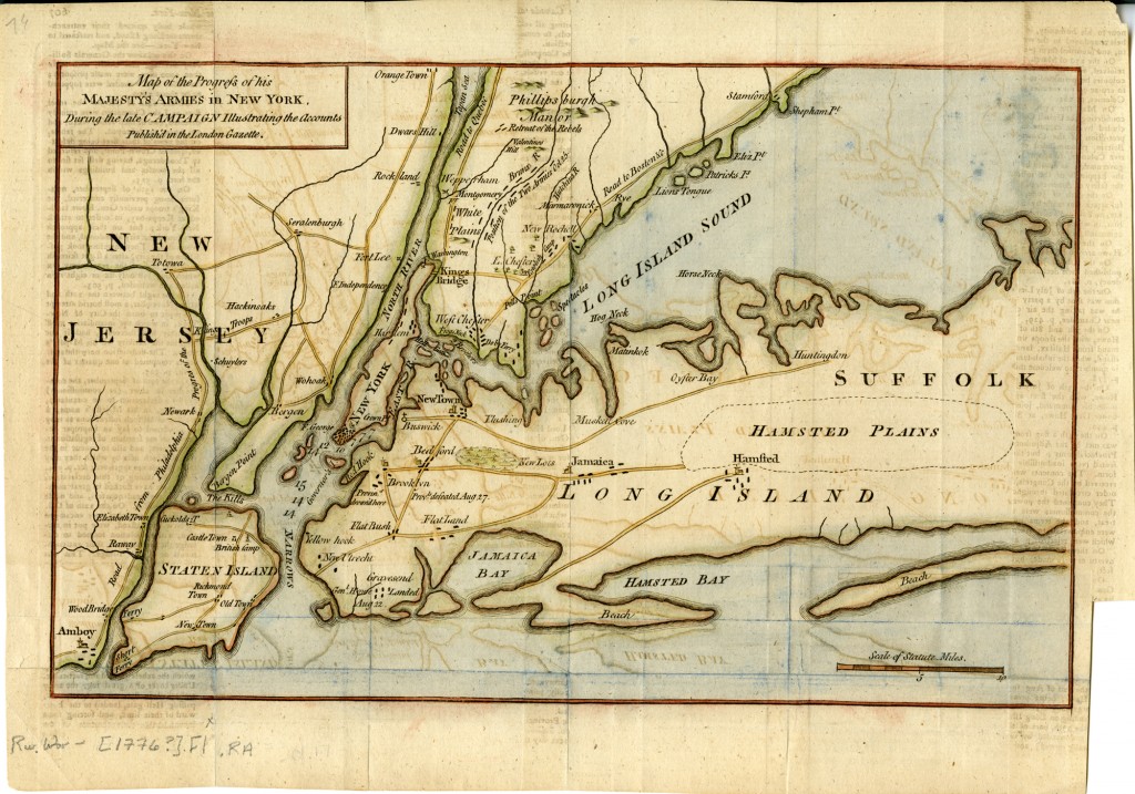
KING'S COUNTY, 1776: This map, featured in a 1794 book about the American Revolution, chronicled New York and its environs in the late 1770s. Sketch of General Grant's position on Long Island, circa 1793; Map Collection, Rev. War-[1776?].Fl.RA; Brooklyn Historical Society.
Caption
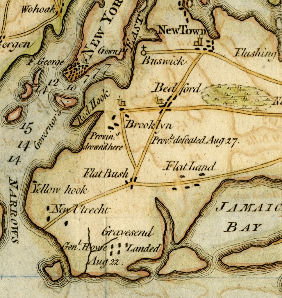
KINGS COUNTY, 1776: The small town of Flatbush is depicted on the map. At the time of the American Revolution, most of Kings County was farmland, and less than 5,000 people called it home. Sketch of General Grant's position on Long Island, circa 1793; Map Collection, Rev. War-[1776?].Fl.RA; Brooklyn Historical Society.
Caption
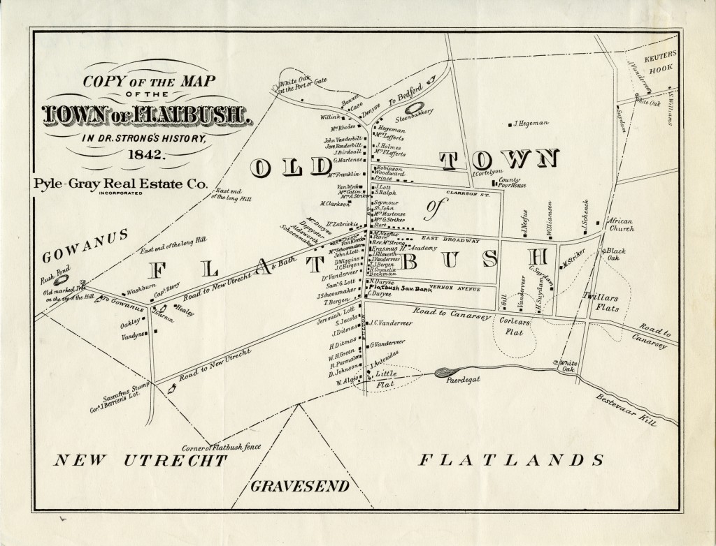
FLATBUSH TOWN, 1842: This map of the town of Flatbush in 1842 was published in Dr. Thomas M. Strong's The History of the Town of Flatbush, in Kings County, Long Island. It depicts natural and manmade landmarks, roads, and farms, along with the homesteads of Flatbush residents. Copy of the map of the town of Flatbush in Dr. Strong’s history, 1842; Map Collection, B A 1842 [19--?].Fl; Brooklyn Historical Society.
![ba_[1873]a.Fl](https://lefferts.brooklynhistory.org/wp-content/uploads/sites/2/2011/11/ba_1873a.Fl_1-1024x696.jpg)
Caption
FLATBUSH TOWN, 1873: This map shows the town of Flatbush transitioning from farmland to suburb. Flatbush, town of Flatbush, Kings Co., L.I., 1873; Map Collection, B A-[1873]a.Fl; Brooklyn Historical Society.
![ba_[1873]a.Fl crop](https://lefferts.brooklynhistory.org/wp-content/uploads/sites/2/2011/11/bhs_ba_1873a.Fl_-1024x710.jpg)
Caption
FLATBUSH TOWN, 1873: John Lefferts' farmland remained intact in 1873, but planned streets (demarcated by dotted lines) would soon cut through the Lefferts family's land. To the south, smaller residential lots predominated. Flatbush, town of Flatbush, Kings Co., L.I., 1873; Map Collection, B A-[1873]a.Fl; Brooklyn Historical Society.
Caption
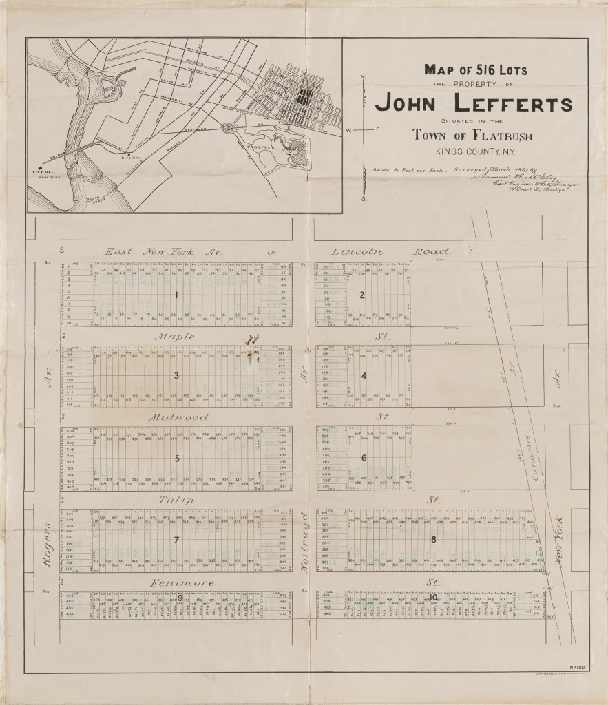
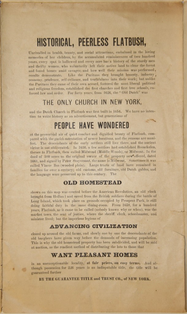
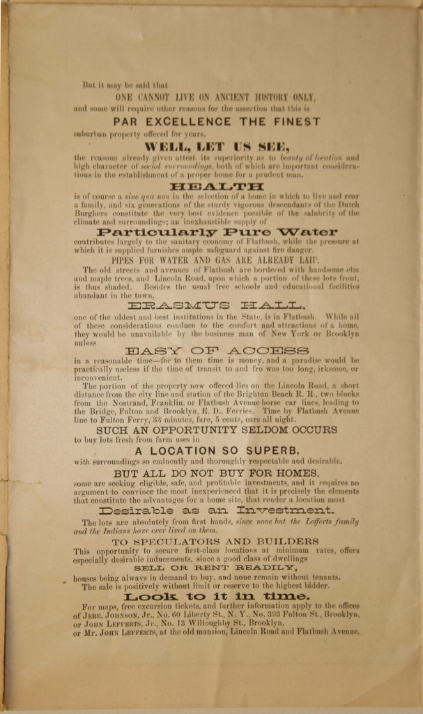
FLATBUSH TOWN, 1887: This 1887 map advertised the sale of 516 lots of Lefferts land going to auction. Advertisement for Land Owned by John Lefferts, 1887; Lefferts family papers, ARC.145, box OS3, folder 2; Brooklyn Historical Society.
Caption
FLATBUSH TOWN, 1887: The auctioneer for the Lefferts family drew on Flatbush's rich Dutch heritage to sell new suburban housing lots. Advertisement for Land Owned by John Lefferts, 1887; Lefferts family papers, ARC.145, box OS3, folder 2; Brooklyn Historical Society.
Caption
FLATBUSH TOWN, 1887: The map also indicated the amenities that Flatbush offered: schools, clean water, healthy environs, and newly-built transportation lines. Advertisement for Land Owned by John Lefferts, 1887; Lefferts family papers, ARC.145, box OS3, folder 2; Brooklyn Historical Society.
Caption
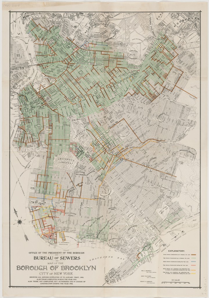
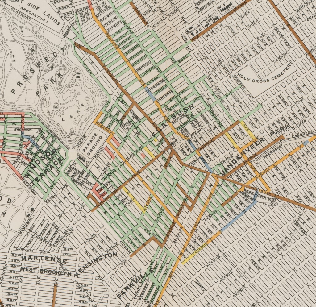
BROOKLYN BOROUGH, 1902: This map charted the laying of sewer systems in Brooklyn only four years after the consolidation of Greater New York City. Bureau of Sewers, Map of the Borough of Brooklyn, City of New York, showing all sewers completed up to January, 1902; Map Collection, B A-[1902].FL; Brooklyn Historical Society.
Caption
BROOKLYN BOROUGH, 1902: Though some suburban development had occurred in the Flatbush neighborhood, its sewage infrastructure was less developed than that of downtown Brooklyn. Other areas like Flatlands showed almost no development at all. Bureau of Sewers, Map of the Borough of Brooklyn, City of New York, showing all sewers completed up to January, 1902; Map Collection, B A-[1902].FL; Brooklyn Historical Society.
Caption
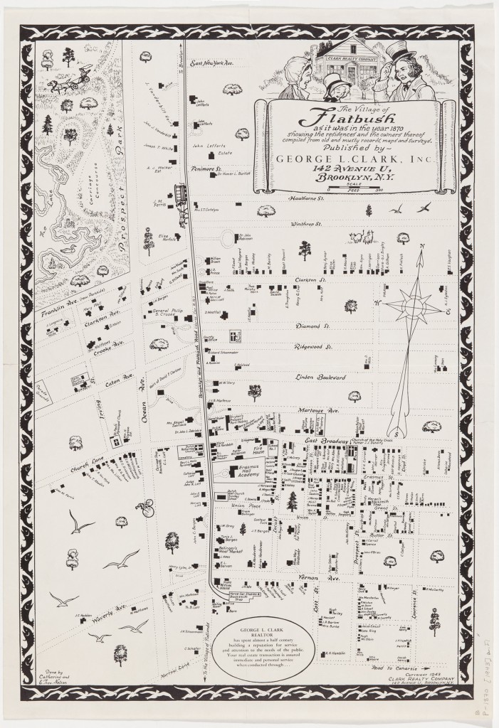
FLATBUSH NEIGHBORHOOD, 1943: Clark Realty Company created this map in 1943 to sell residential housing in bustling Flatbush. The village of Flatbush as it was in the year 1870, 1943; Map Collection, B P-1870 [1943].Fd; Brooklyn Historical Society.
Caption
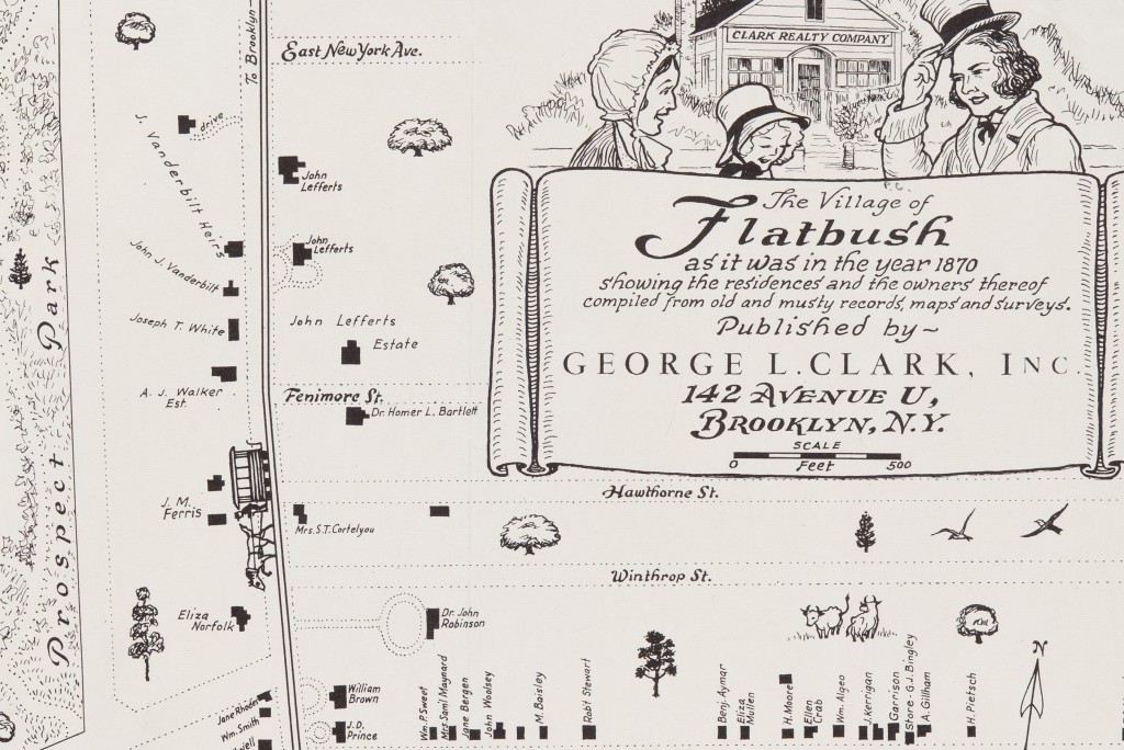
FLATBUSH NEIGHBORHOOD, 1943: Though Flatbush was becoming a neighborhood of apartment buildings and busy streets, Clark Realty Company drew on the area's rural past to draw renters and buyers. The village of Flatbush as it was in the year 1870, 1943; Map Collection, B P-1870 [1943].Fd; Brooklyn Historical Society.

